« work, not service | Main | citizens in the economic recovery plan »
November 25, 2008
mapping Boston's civil society
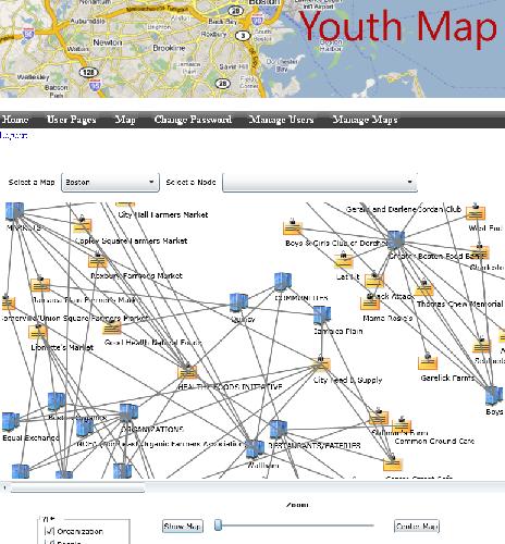
We're busy mapping Boston. Students place nodes that represent people, ideas, or organizations on a blank plane. Each node stores data, such as contact information, goals, activities, and geographical locations. Connections among nodes represent real collaborations. The data can be shown in lots of ways--on a geospatial map, as a network diagram with various center-points, as a list of search results. Ultimately, this software will be an application for Facebook and MySpace, making it easy for people to add or use data . For now, we have a standalone website.
Here's a screenshot from today. This represents the work of just a few Tufts undergrads over a couple of weeks. We're already working with students at UMass Boston and will be expanding beyond those campuses in the spring. The software is also capable of automatically harvesting organizations and links from the Web and pasting them here to be analyzed by human beings.
Purposes:
- Recruiting people and organizations. One can search for individuals who are connected, even indirectly, to a given issue and then ask them to participate in events or projects.
- Finding opportunities. One can search for places to volunteer, give money, or organize politically. The search can be by key-word. More interesting is to search for organizations that are linked to other organizations.
- Analysis and deliberation. One can link two issues together, or link an issue to an organization, and then debate the connection. Is homelessness worsened by zoning? That hypothetical connection can be discussed on the map itself.
- Broadening sources. Journalists, government agencies, foundations, and researchers tend to ask the same people for information and opinions. They often rely on formal credentials as evidence of knowledge. The network map can lead them to overlooked citizens who are useful sources because of the social roles they play.
- Investigations. One can look for inappropriate or problematic connections, or lack of connections.
Issues that students have brought up so far:
- Privacy: Whose information should go on the map, and who decides that?
- Chilling effects: Would people be discouraged from linking to controversial organizations and causes if their links could be mapped?
- Spam and other bad stuff: Inappropriate content can be added to the map
- Marketing: Instead of recruiting volunteers or activists for a social cause, a company could use the map to find influential customers.
- Sustainability: It's fun for me and my colleagues to build the map. But other people who contribute need to know that it will still be there (and kept current) in five years.
- Limits: This is a Boston area map. That geographical definition gives it useful density. But Darfur could belong on the map, since Boston-area students work on Darfur. Former Bostonians could place themselves on the map. Is there any point to a geographical limit?
November 25, 2008 12:01 PM | category: Boston-area social network , Internet and public issues | Comments
Comments
Is this a publicly available software that can be experimented with or is it under lock and key for now?
November 25, 2008 4:13 PM | Comments (1) | posted by Jim